This blog is a continuation of yourcameraisnotbigenough (http://yourcameraisnotbigenough.blogspot.com/ ), a blog about our outdoor adventures. Blogspot has been increasingly more difficult to use and the iPhone app is no longer supported. I had actually stopped posting for about six months because it takes so long to upload photos, and I can’t do it from my phone. So, I’m moving. I would like to invite all my old friends and followers to continue to follow me here. Hopefully I will gain some new ones as well.
The blogspot site (http://yourcameraisnotbigenough.blogspot.com) will remain up because there are a bunch of great posts there and it continues to see traffic. If you are new to my blog and like it, it is definitely worthwhile to check out my old blog as well, as this WordPress blog is more of a continuation of what I started about three years prior.
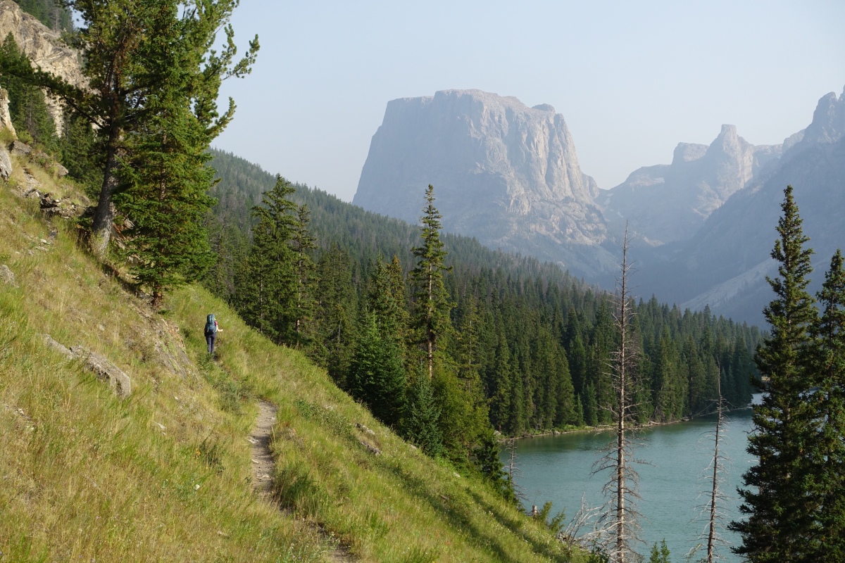
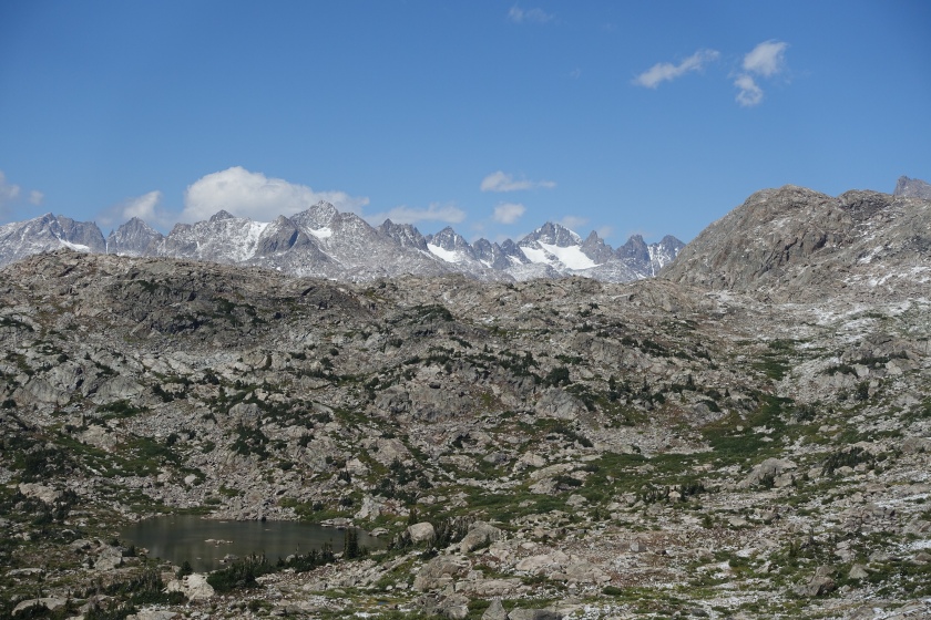
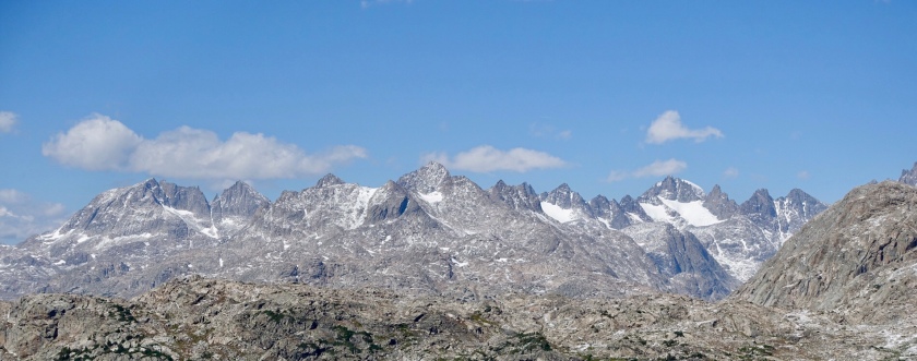
The Continental Divide runs through the center of the 100 mile long Wind River Range of western Wyoming. It features 2,800 square miles of unbroken wilderness, over 2,900 lakes, 181 glaciers, and 41 peaks over 13,000 feet. Both grizzly and black bears call the range home, as do moose, wolves, elk, and the full spectrum of the American West’s greatest wildlife. To call the Winds wild and huge is to understate the sheer grandeur.
In the last week of August, 2018, we undertook a 92 mile trip through the range, traveling from Green River Lakes, on the western end, to Big Sandy, on the southeastern end, with a side trip over the continental divide at Washakie Pass, returning back over Haily Pass. This was made possible by Great Outdoor Transpotation, a company which relocated our car from the starting trailhead by the three hour drive to the ending trailhead, burning the ship for any bail out options.
For this post, I opted to maintain a daily journal of our trip to capture the day-by-day ups and downs. This is our account.
Day 1: Saturday
“Arrived at Pinedale, WY around 2 pm after a split, 18 hour drive. Enough time for a quick stop at the fly shop for the proper flies and some advice.
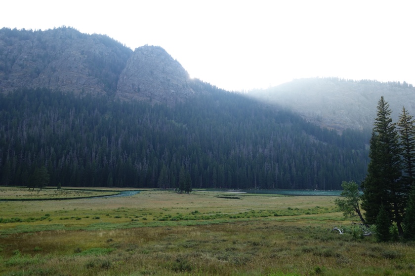
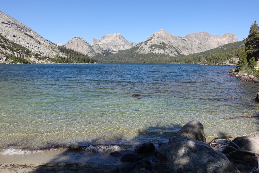
Conditions were smokey and windy. The strong winds carried smoke from 100s distant fires, devastating the west yet another season. It took an hour to walk the massive length of the first of the two glacial Green River lakes. The rugged features of the continental divide and the indigo water felt more like New Zealand than anywhere in the Americas.
We made camp along the green river, beneath Flattop Mountain. A large beaver swam in the river.
Day 2: Sunday
A huge male moose trotted across the meadow adjacent to our camp as we finished breakfast. This place is so amazing! A moose and a beaver, and we just arrived!
With rain in the forecast, we may not be able to go as far as we had planned tomorrow, so we decide to focus on making miles. We spent the first half of the day climbing the 10 or so miles up Green River Pass.
A cold wind blew increasingly heavier clouds through at high speed, and as we climbed the very steep pass, the realization that our car was being moved about 70 trail miles away combined with the realization that the Winds are not the Sierras- neither the terrain nor the weather are in any way friendly.
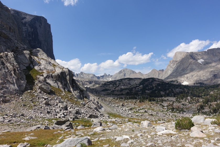
After Green River Pass , there seemed to be very little downhill. Short steep downhill sections were truncated by steep, long uphill slogs as we continued to ascend higher and higher into the alpine backcountry.
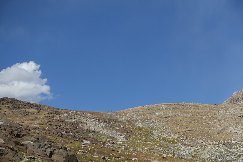
We wanted to stop somewhere around our 15 mile mark for the day, but we could not identify a flat, dry price of land. So we carried on, buffeted by gale wind in the beautiful, bizarre, glacially carved, alpine landscape of some of the highest trail sections in the Winds.
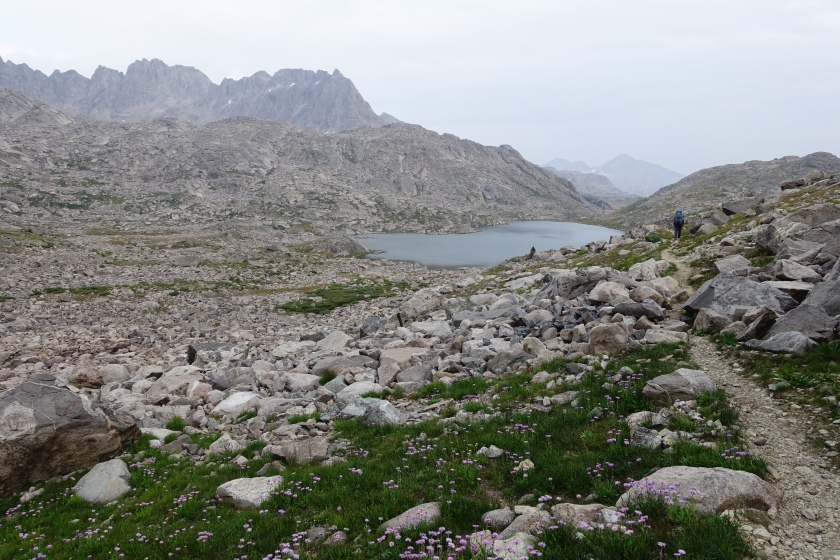
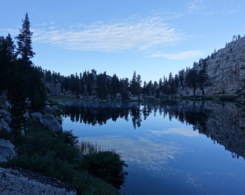
We finally found a suitable site near #censored location # as darkness approached (not too late to catch a few cutthroat trout). We had covered 19 hard miles and were fully exhausted. It was a beautiful, solitary location high in the alpine, with close-up views of the far side of Titcomb Needles and various granite peaks of the Continental Divide.
Day 3:Monday
We woke to the pattering sound of snow on the tent at around 4 AM. It continued all morning. We considered our car, now relocated over 60 miles away. No going back.
The snow fell all day. 12 hours straight. The trail: no longer visible. The options: hike out 20 miles in the snow to a trailhead that our car is not parked at, try to hitch a ride to town, then eventually to another trailhead three hours away, or sit and wait. We talked about the unlikelihood of a Donner Party scenario. Surely, it would eventually stop. It had to, right?
The snow let up at around 6 pm- enough time to make dinner and catch a few fish. During which time, two women with Minnesota accents hiked by, leaving tracks in the snow that could become useful in helping us stay on the snow on trail in the snow covered landscape on our way out tomorrow.
It was night again, so we went back in the tent. We had not made an inch of progress in 24 hours. We were awoken at 10:30 PM by the sound of heavy snowfall on the tent. It was a soul crushing moment. The tracks would be erased. Would we complete our plan? Would snow cover the planned path for the rest of our journey? Would we be able to keep dry, or find our way? Would we ever see the sun again? My mind wandered to trips of multiple consecutive days of precipitation- it is possible for these conditions to continue for a straight week or more. I know, I have lived it.
Day 4: Tuesday
The sound of snowfall in the tent woke me a second day at 4 AM. This is when I experienced the closest thing to panic I can remember in a while.
Then, it stopped. Brightness. All at once, the light of a full moon illuminated the tent. The snow, still piled on top, cast shadows through the thin wall of material separating us from the cold air.
our home for two nights and a day
Surprisingly warm sunshine melted snow quickly. As we descended, 1 foot of snow transformed to 3 inches of slush, then just a muddy trickle on the trail.
Climbing Lester Pass
We stopped mid afternoon at a creek and catch dinner- brook trout . Day closed in a beautiful subalpine basin.
Day 5: Wednesday
We woke to ridiculous cold. How cold? When you camp in cold, you develop habits to keep your stuff from freezing. Normally, things stored in the tent, next to your body heat, bedding and clothes, tend to stay warm, at least above freezing. Our water, stored in bottles next to us and our sleeping bags and cloths in the tent, had frozen overnight. I had never seen this before. This was equivalent to sleeping in a walk- in freezer, inside the tent. Of course, outside the tent it was much colder. We put on double socks to insulate our feet from our now frozen solid boots. We determined to make up miles lost Monday so we could do a side trip we had originally considered.
The terrain did not cooperate with our plans. Despite our dedication to our itinerary, an unending series of several hundred feet steep gains and losses slowed our progress. Amazing Wyoming blue sky.
The fish woke up mid afternoon and we had some great fly fishing in a small corner of one of many wind blown lakes. Among many others, Lori caught a golden trout. We hiked till sunset. At last the grade and terrain became more gradual.
Just before sunset, while walking through a winding meadow, a pack of wolves howled back-and-forth to one another. The unmistakable hollow droning was infinitely more chilling than the endless frozen wind. At the same time, the wildness of the experience was equally, strangely beautiful. One sounded to be about 150 yards away. This was a pack of large predators hunting a prey animal 5 times my size. Suddenly the heavy, large frame .500 S&W revolver I had resented up the steep terrain that morning seemed well worth the effort to have at my side, even if only for the illusion of self-efficacy it offered.
Day 6: Thursday
Still needing to get miles lost from Monday back behind us to complete our itinerary, we again hiked dawn till dusk.
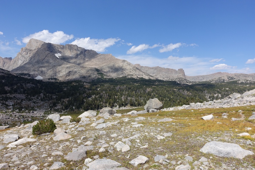
This time, the going in the morning was fairly flat.Although still between 9,500 and 10,500 feet, the scenery opened up to a more Wyoming range feel, with high grassland and whipping wind. The lakes we passed were choppy from the relentless wind.
We entered our side trip, a 20 mile loop featuring two passes over the Continental Divide: Washakie Pass and Haily Pass.
Clouds blew through quickly as we ascended Washakie Pass in the afternoon, the trail conditions returning to the rugged, steep standard of the Winds.
Washaki Pass, west side
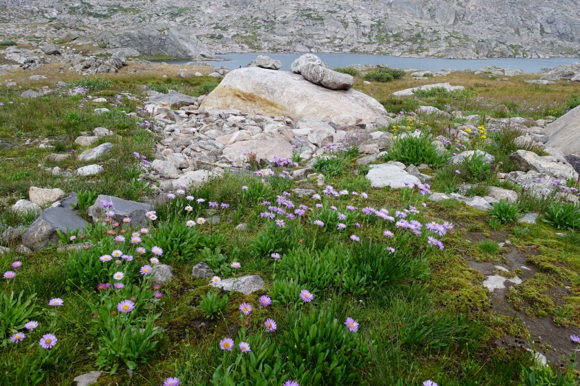
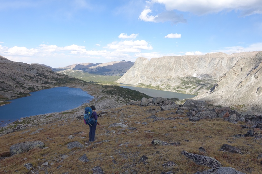
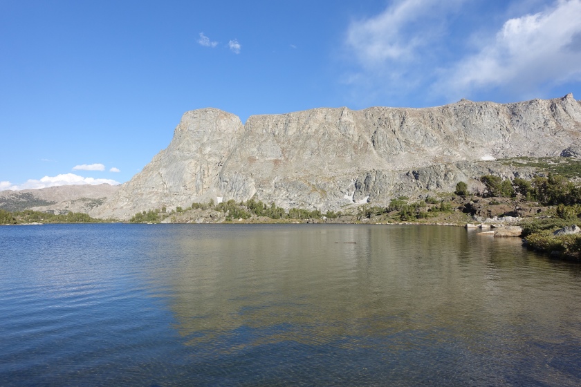
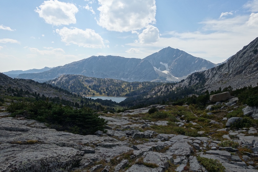
The far (east) side was marked by treacherous grade and loose footing. The unbearable whipping wind at the pass made it difficult to find the route while circumventing the sheets of ice blocking the regular trail. The views: second-to-none: granite, glaciers, alpine lakes, meadows.
Macon lake, Washakie Lake
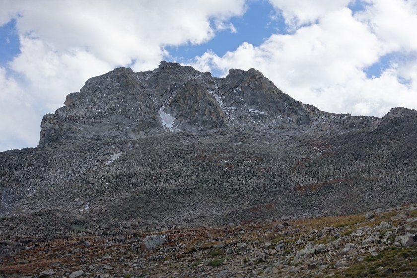
Washakie Glacier
Another difficult, long, beautiful, windy, rugged 18.5 miles. Still, we had a few minutes to catch a dozen or so trout in the #censored location # before dark set in.
Day7:Friday
Despite or efforts to escape it by camping low and in the trees, gail wind shook the tent all night. Rain overnight made me question the decision to make a side trip on the far side of the Continental Divide so shortly after getting socked in snow. Would the pass be snow covered? If a foot of snow were to fall, we might not be able to get back across Haily Pass. The map stated that Haily Pass is “Not suitable for livestock”. Is that to say that, Haily is even steeper than Washakie? Here we were, nearer to our car, but we had gotten greedy and set ourselves up on the other side of the Continental Divide.
We took it easy in the morning, feeling uneasy and worn down. More excellent fishing in the morning, then a very scenic ascent past Grave lake over Haily pass, an exceedingly steep ascent just below the pass.
We finished up the day camping at Marms Lake several miles beyond Haily Pass
Day 8: Saturday
We made a quick getaway, 8 miles out, past hoards of people going inbound on the first day of Labor Day Weekend. The inbound were mostly college – aged, dressed-in-shorts-with-no-hats, carrying poorly packed crispy new packs. It was a shocking dichotomy compared with days of almost complete solitude and harsh conditions. Our vehicle awaited our arrival at the Big Sandy Trailhead, 92 rough trail miles from where we had started.
We reflected on our week, and this was decidedly the most arduous trip we had ever done. Did we regret it, in light of the nonstop wind, cold, difficulty , pain, fear, danger, and uncertainty? And miss this unimaginable beauty? Absolutely not!”
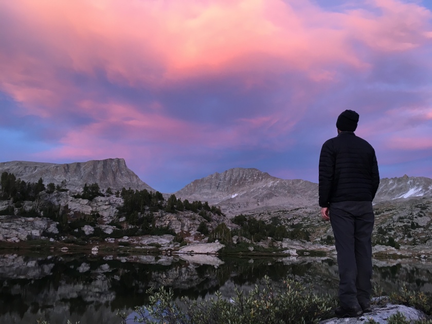
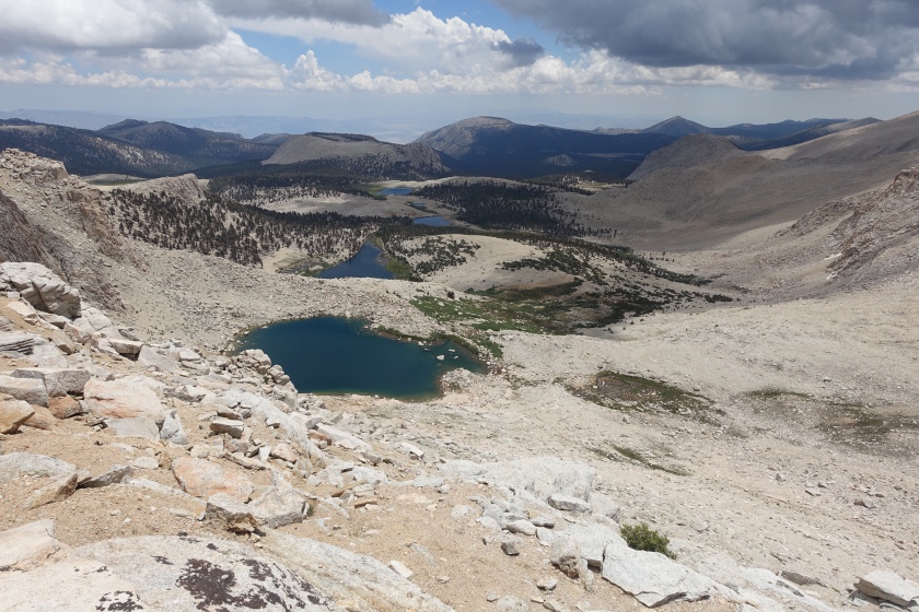
We drove 9 hours each way from Tucson to the eastern Sierra for a short, three day backpack. We left Friday night after work and drove until midnight for a short four hours of rest in Palm Springs, waking at 4 am to complete the journey to the Eastern Sierra Visitor center, taking a leap of blind faith that we would be able to get a walk-up permit. We could have been turned away empty handed and restricted to day hike only, as backpacking is by permit only and space is limited.
But it was my birthday, and we got a break. We were able to get permits into the Cottonwood Lakes area.
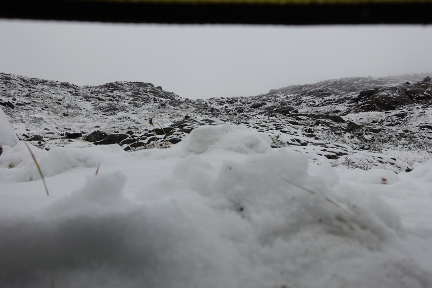
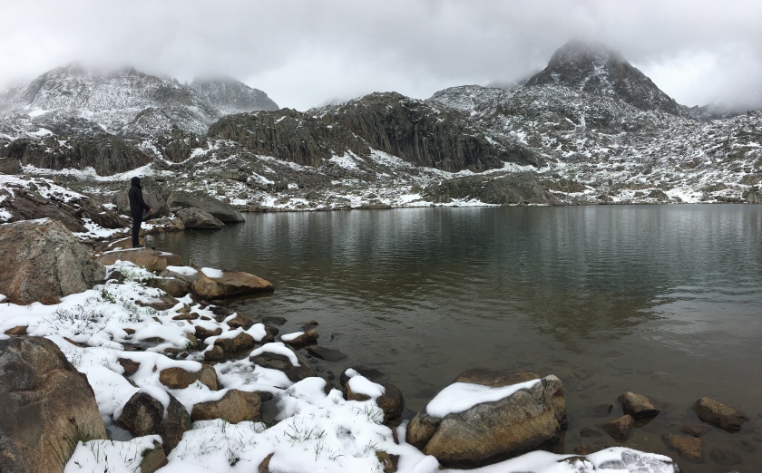
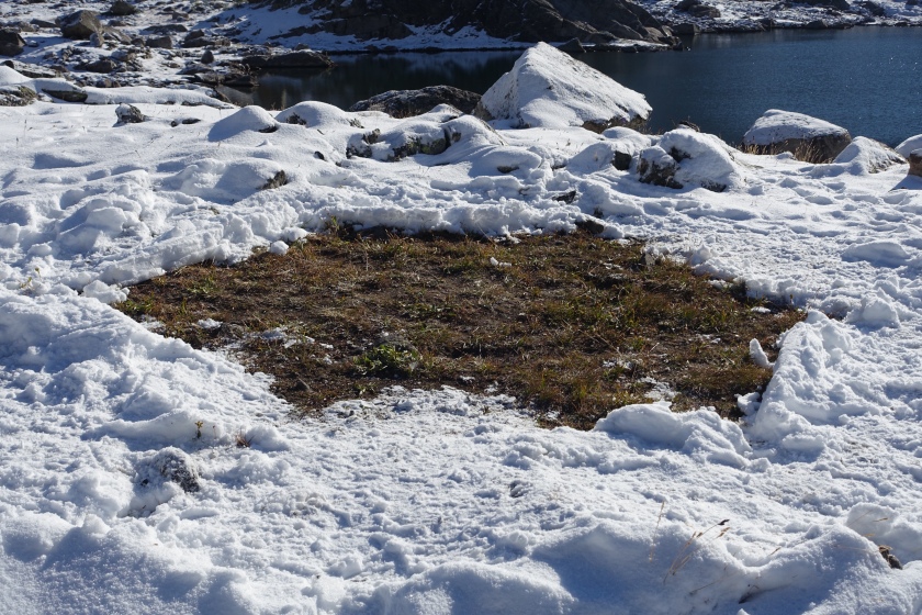
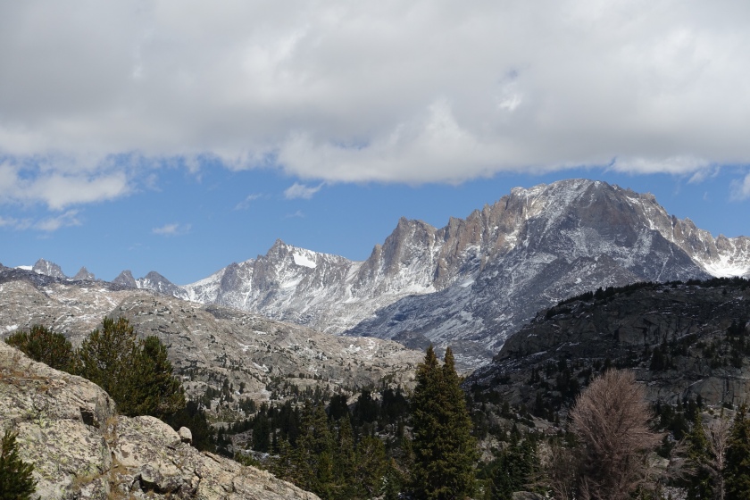
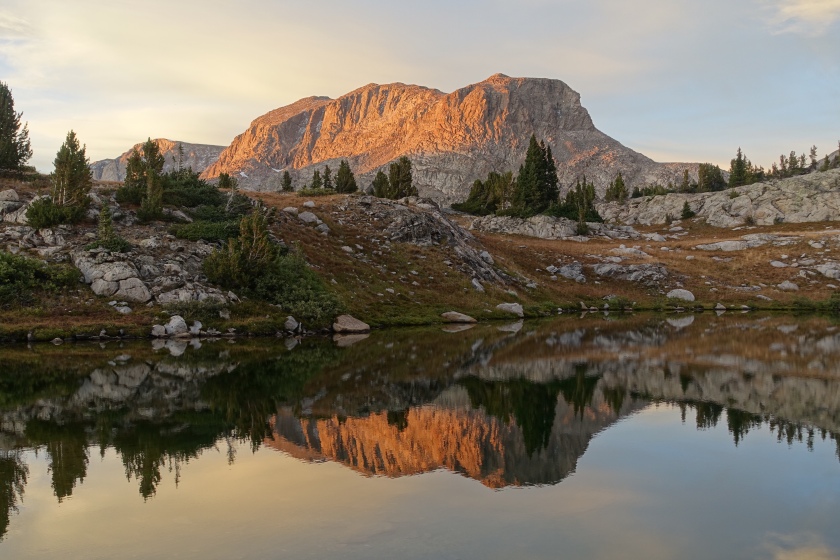
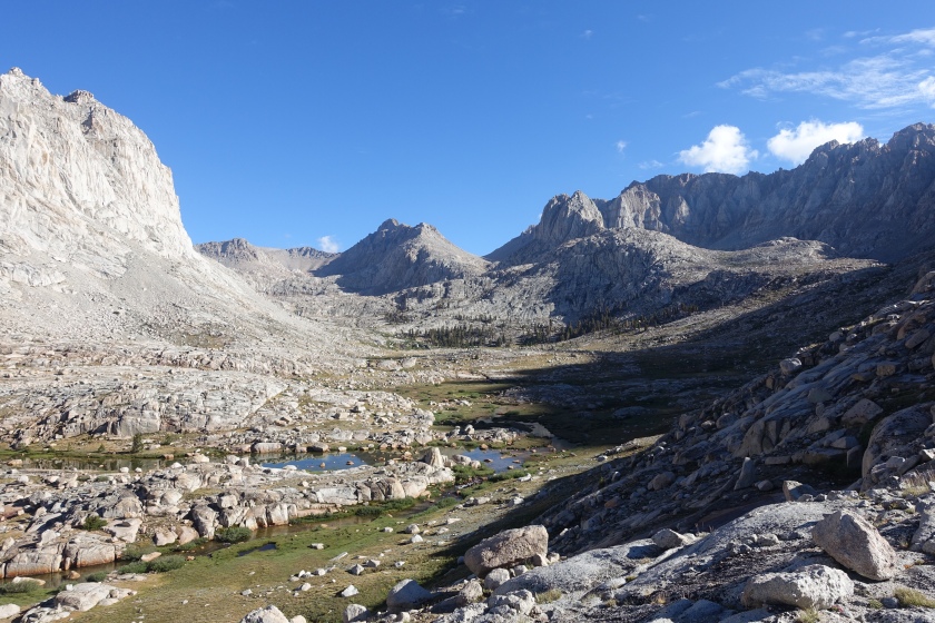
The trip had a taste of everything the full JMT offers: a gradual climb from lodgepole pine up into foxtail pine, subalpine scenery giving way to alpine meadows complete with marmots, subalpine and alpine lakes and tundra, a fantastic 12,000 foot pass with outstanding views (New Army Pass), a vast, high alpine basin on the west side of the eastern divide, and a chance to summit the 14,000 + foot My Langley. It was like a mini JMT.
Marmot, overlooking his kingdom in the high Sierra A large alpine basin featuring a host of 13000-14000 foot peaks and spires
View from Old Army PassMt LangleyCottonwood Lakes, from New Army Pass
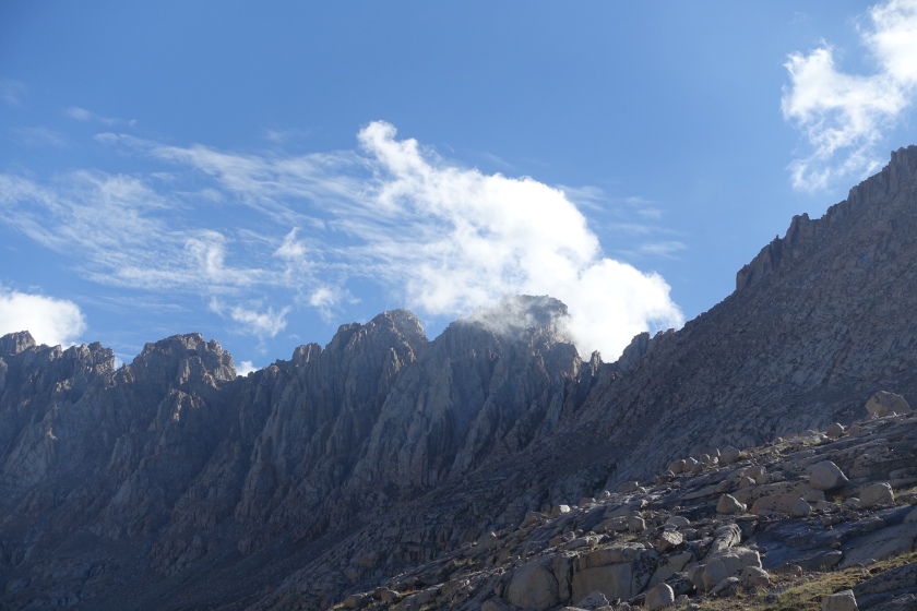
Protracted afternoon thunderstorms rendered our short trip even shorter, and prevented our ascent to the 14000 foot summit of Mt Langley. Violent wind ripped at our rainwear, hurling diagonal hailstones down on us. Lightning touched down within less than a mile of us from clouds just a few hundred feet overhead that were swirling all around and down below. As we went over the 12,000 foot New Army Pass an unforeseen second storm blew in right as we reached the crest on day one. I clearly remember and will never forget the sight of a lightening bolt originating from a cloud at eye level touching down on the trail no more than 1/2 mile in front of us in the direction we were going. The echoing thunder of those granite cirques will purge worries of a more abstract nature, existential angst, and little atheist out of anyone, if only temporarily.
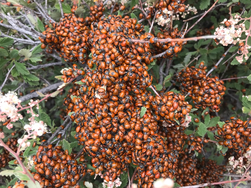
I met millions of tiny visitors at the top of Mount Wrightson today. Just 8 days ago, I had hiked up to the top of the same mountain and there was maybe a handful. Typically, encountering a singular ladybug in southern Arizona is noteworthy. To see this many, together, is hard to truly appreciate.
Now, just 8 days later, on the same summit that just one week ago was 99% ladybug free, millions of ladybugs had arrived, traveling from far below around the surrounding valleys. I am astonished, considering the experience of a single ladybug. To scale, summiting the high and distant peak would be to them what landing on the moon would be to one of us. Consider that, each one of these millions of ladybugs was scattered hundreds of miles around, solitary or is small groups, doing ladybug things just a few weeks ago.
When did each of these tiny pilgrims set out on their quest to the summit of one of Southern Arizona’s tallest peaks?
Where do they obtain the energy to lift themselves over 6,000 feet and over vast distances from the valleys below?
What lift propelled their tiny wings, lifting their bulky little bodies upwards?
With what guidance system is their pilgrimage directed each year?
With what timekeeper do they coordinate their efforts so they all arrive at the same time?
Here, in the clouds on this small patch of high ground, high above the vast valleys below, I ask these questions about these little pilgrims. It is difficult to walk, sit, or do anything because there are so many. I carefully identify stepping stones and a seat free from ladybugs. I ask how these tiny insects, so sparsely scattered around southern Arizona, could direct such an immense collective pilgrimage. Are each of these tiny, simple creatures truly the master of their own destiny? Or is it more plausible that a more powerful, unseen master has directed their migration to this mass congregation into the clouds?
And what about me? Am I truly so arrogant to believe that I am the master of my own destiny? On my pilgrimage through this world, am I any more aware of what course I take or why than these ladybugs are? As a believer, I know that I am bound for heaven, a concept I don’t comprehend.
Yet, how did I get here? More importantly, how will me being here today lead to heaven, then?
Each of us is now scattered somewhere in the valley below. Each of us, if we are honest, lack the vision or coordination to accomplish anything comparable, in human terms, to the ladybugs’ sojourn. Yet we hope and believe that, like these ladybugs, each of us are being drawn along on a pilgrimage, called by an infinitely more powerful and intelligent force, at the appointed time, to our home in the clouds.
“Listen, I tell you a mystery: We will not all sleep, but we will all be changed—in a flash, in the twinkling of an eye, at the last trumpet. For the trumpet will sound, the dead will be raised imperishable, and we will be changed. For the perishable must clothe itself with the imperishable, and the mortal with immortality. When the perishable has been clothed with the imperishable, and the mortal with immortality, then the saying that is written will come true: “Death has been swallowed up in victory.”
“Where, O death, is your victory?
Where, O death, is your sting?”
-I Corinthians 15: 51-55
We know that the whole creation has been groaning as in the pains of childbirth right up to the present time. Not only so, but we ourselves, who have the firstfruits of the Spirit, groan inwardly as we wait eagerly for our adoption to sonship, the redemption of our bodies. For in this hope we were saved. But hope that is seen is no hope at all. Who hopes for what they already have? But if we hope for what we do not yet have, we wait for it patiently.
In the same way, the Spirit helps us in our weakness. We do not know what we ought to pray for, but the Spirit himself intercedes for us through wordless groans. And he who searches our hearts knows the mind of the Spirit, because the Spirit intercedes for God’s people in accordance with the will of God.
And we know that in all things God works for the good of those who love him, who have been called according to his purpose. For those God foreknew he also predestined to be conformed to the image of his Son, that he might be the firstborn among many brothers and sisters. And those he predestined, he also called; those he called, he also justified; those he justified, he also glorified. -Romans 8:22-30
“Then I saw “a new heaven and a new earth,” for the first heaven and the first earth had passed away, and there was no longer any sea. I saw the Holy City, the new Jerusalem, coming down out of heaven from God, prepared as a bride beautifully dressed for her husband. And I heard a loud voice from the throne saying, “Look! God’s dwelling place is now among the people, and he will dwell with them. They will be his people, and God himself will be with them and be their God. ‘He will wipe every tear from their eyes. There will be no more death’ or mourning or crying or pain, for the old order of things has passed away.”
He who was seated on the throne said, “I am making everything new!” Then he said, “Write this down, for these words are trustworthy and true ” Revelation 21:1-5
Am I any different than these ladybugs? Will I one day reach the end of my pilgrimage in a congregation in the sky? I believe I will, but no more by my own might or merit than these ladybugs who reached theirs.
“Not that I have already obtained all this, or have already arrived at my goal, but I press on to take hold of that for which Christ Jesus took hold of me. Brothers and sisters, I do not consider myself yet to have taken hold of it. But one thing I do: Forgetting what is behind and straining toward what is ahead, I press on toward the goal to win the prize for which God has called me heavenward in Christ Jesus.” – Philippians 3:12-14
The Arizona Trail is many things- hot, cold, dry, remote, difficult, rugged, and amazing. Completion of the trail, either in sections or all at once, poses a number of unique logistical challenges.
We decided to hike the northernmost section during our week off in May 2018. The biggest challenge in completing this section may actually be getting started. To get there, you have to drive around the Grand Canyon.
To make things more interesting, the 75 trail miles between the north rim and the Utah border are nearly waterless. The best way to address this is to cache your own water by driving 4WD roads to access points along the trail and dropping off gallons of water for your future self prior to starting.
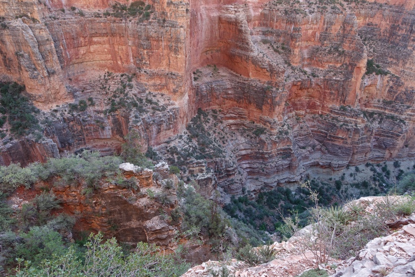
Starting in Tucson, we did the driving and water caching all in a very long single day, then drove back around the Grand Canyon to the town of Tusayan, where we would spend the night and leave our car. The drive was spectacular, featuring the beautiful and bizarre landscape of the sandstone country north and east of the Canyon, the Vermillion Cliffs, and a beautiful South Rim sunset.
The following morning, a private shuttle picked us up an drove us the four hour drive from Tusayan, south of the south rim, back around the Canyon, up through Page and across southern Utah, then dropped us off at State Line Campground, the northern terminus of the 800 mile Arizona Trail.
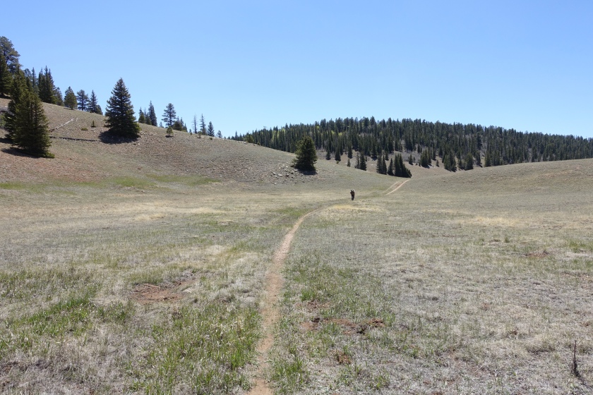
When traveling southbound from the Utah border, this section starts in the sagebrush high desert of southern Utah.
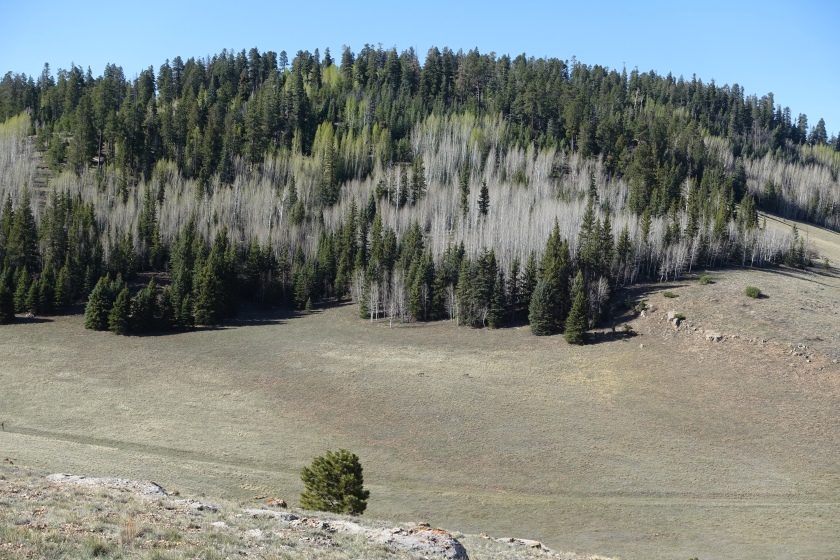
The trail gradually climbs the Kaibab Plateau, which is a large sandstone plateau not dissimilar to the Mogollon plateau, only it is not as flat as the Mogollon.
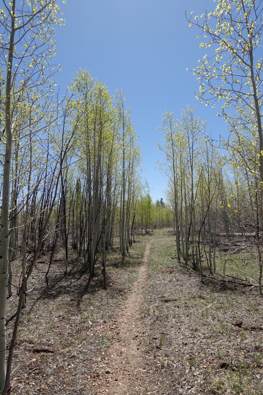
The ascent up the Kaibab Plateau is a gradual, undulating ascent, with the environment slowly progressing from sagebrush to juniper, piñon pine, ponderosa, and finally dense fir forest which unfolds over the 75 miles from Utah to the North Rim.
The relatively easy terrain (until the Canyon, that is) and fairly redundant landscape, coupled with a lack of water, call for high miles. Our average for the trip was in the high teens, with some days up to 20 miles.
While relatively easy, the miles do add up. Normally, backpacking trips for us range from 8 mile days to 14 mile days. The added weight of carrying all your stuff really slows you down on the hills, and landscape and water sources typically dictate the distance traveled. As a result, I had never done this kind of mileage before, and in the midday, my feet and body were hurting a bit, still with 8 or more miles ahead.
The surprising thing to me was that the pain would, over the miles, become more bearable. It did not go away, but it was like I didn’t care. This is something that I have heard many times from patients I have cared for with serious pain when asked about the effectiveness of pain medications. I do believe there is a physiologic link.
We were blessed to find one room available at the North Rim on night five of our trip, and we enjoyed pizza, beer, ice cream, and a hot shower.
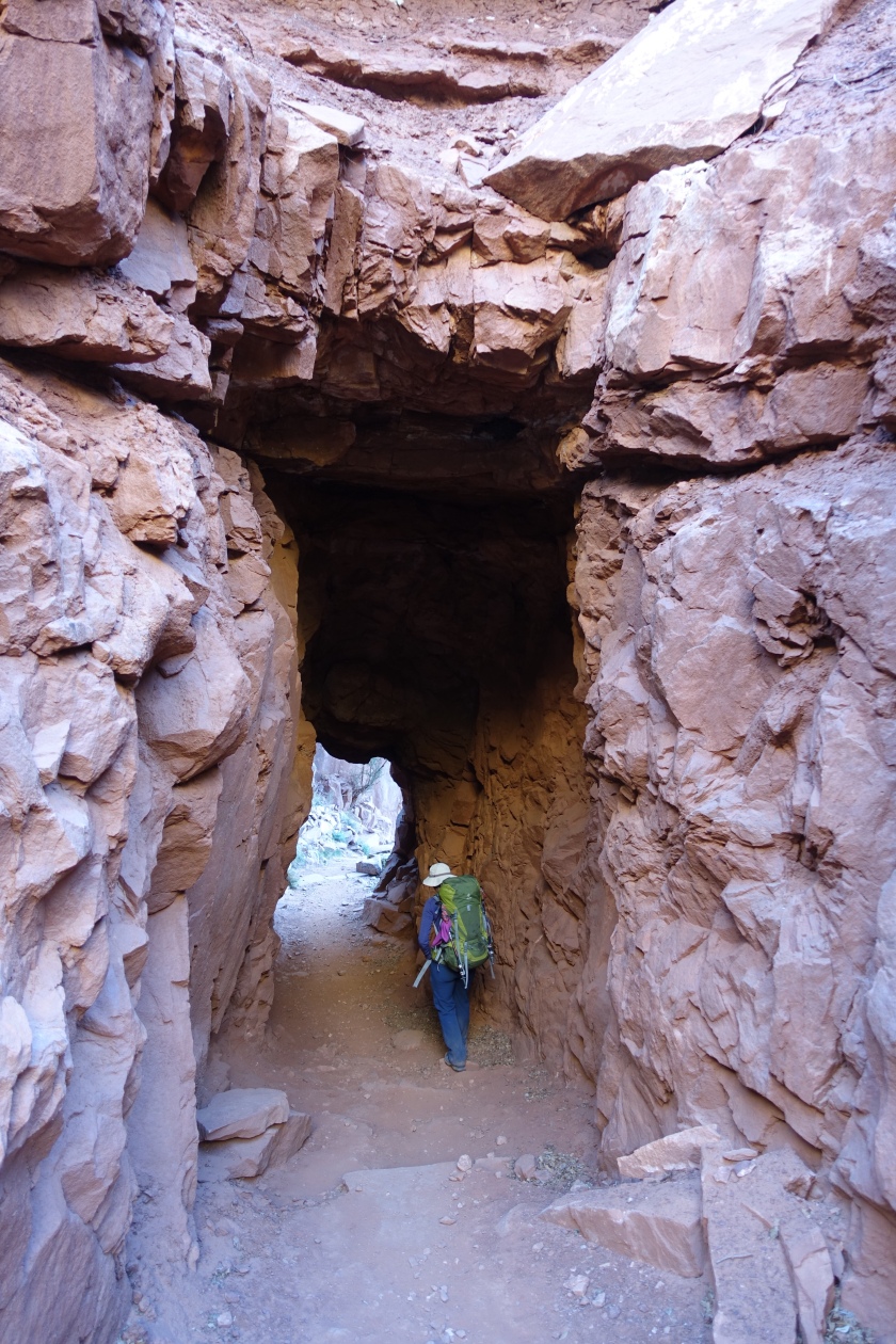
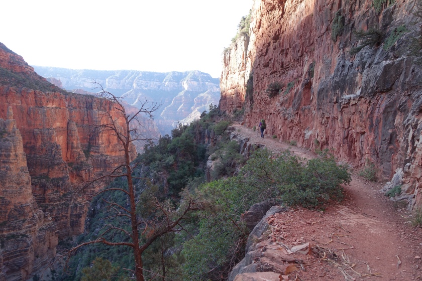
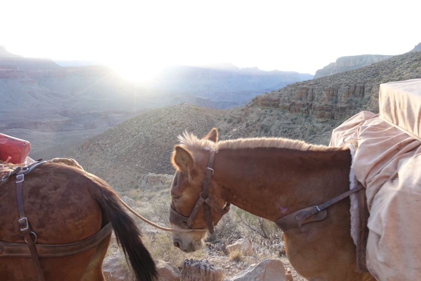
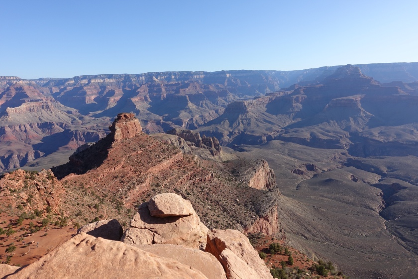
We spent our last night at the Bright Angel campground near Phantom Ranch at the bottom of the Grand Canyon in our traverse back across, this time on foot.
On our seventh day, we climbed out of the Canyon on the South Kaibab trail, then hiked another 9 miles south along the AZT back to our car, still parked at the hotel we had stayed at a week prior in the town of Tusayan.
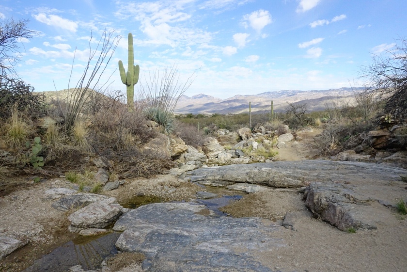
A few weeks ago I wrote about the harkening of the Rincons from Wasson Peak (see: An Ode to the Death March).
This weekend, we had a chance to answer the call. The Rincons offer over 60 square miles of roadless, fenceless mountain wilderness. I have never hiked into the Rincons and returned disappointed. This would be our fourth backpack into the range, which offers many options. This time, the night before the start of our trip, we shuttled a vehicle to the Miller Creek trailhead on the east side of the range where we would ultimately finish.
We the started out at the Douglas Spring trailhead, at the eastern terminus of Speedway blvd, on the west side of the Rincons.
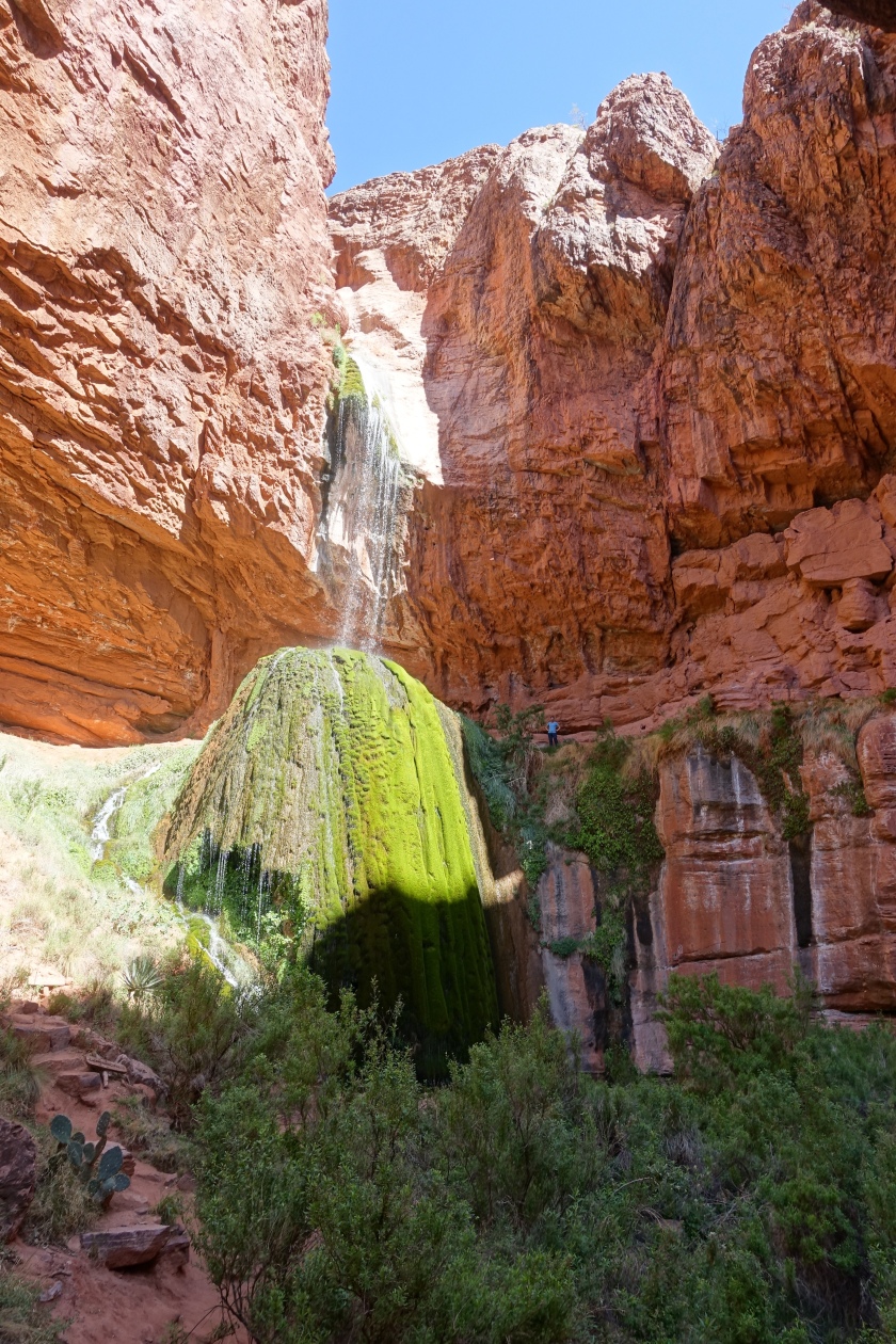
Bridal Wreath Falls, a short, signed side trip three miles up the Douglas Spring trail.
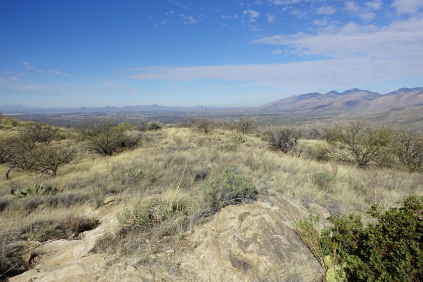
Looking back at Tucson, from the Douglas Spring trail.
Vista above Cowhead Saddle looking back at the shrinking Santa Catalinas
Behind Helen’s Dome, on Mica mountain.
We camped at Manning camp, near the top of Mica Mountain. Manning camp offers tall stands of mature trees and the range’s only 100% reliable water source. Getting to the 8000 foot locale at the center on the Rincon range can be a bit of a death march, regardless of which trailhead you choose. all six trailheads are more than 10 miles, 4000 feet away. This thins out the crowds, one of the Rincon’s greatest strengths.
Sunset, from Manning Camp.
Looking back at Wasson Peak, from Manning Camp.
On day 2, we hiked out by descending southeast, past Devil’s Bathtub, then down Heartbreak Ridge Trail.
View NW from Heartbreak Ridge, the Tucson Mountains and Catalinas just barely visible in the distance through Cowhead Saddle.
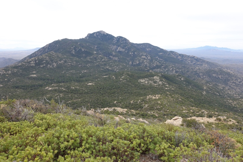
I think Rincon Peak’s best side is the north face, seen here from Heartbreak Ridge during our hike out.
We took the Miller Creek Trail down from Happy Valley Saddle, returning to our car in the east side of the range we had shuttled to that location two nights before.
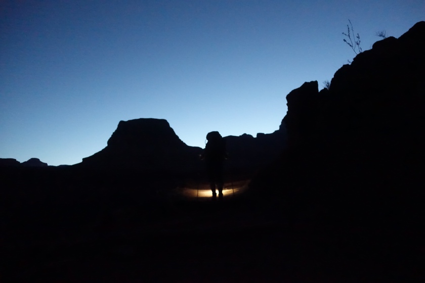
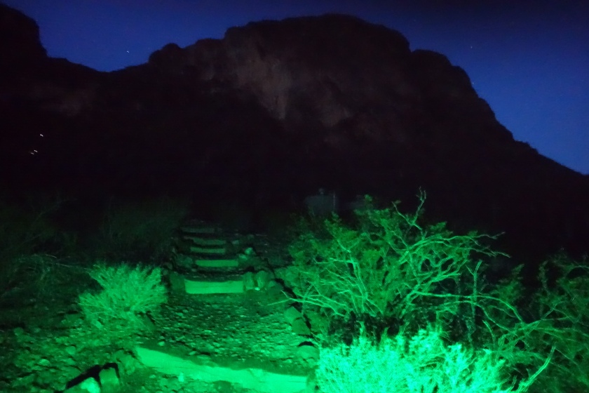
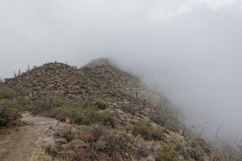
It was darker than the inside of a cow as I stepped out onto the trail this morning. An atypical fog blocked out any of the ambient light I was accustomed to in my ascent into the darkness. I’m hiking Picacho Peak solo. My typical routine is to start before first light and ascend aided by a dim green headlamp. This prevents conversation of rhodopsin in the rods of the retina, allowing for a more natural experience; enhanced peripheral vision and increased awareness of the first natural light. A bonus is sunrise at the summit.
It wasn’t my plan to hike Picacho this morning but I couldn’t sleep.
Starting a hike before first light is an interesting experience. When restricting awareness to the five senses, the pre-morning start is a decidedly unnerving experience, especially alone. Today it is pitch black with only the ground in front of me. No birds, no people, no landscape. Even the drone of I-10 is muted by the fog.
Expanding my awareness to the intellectual, I do believe that the earth is in fact in rotation, which will cause the sun to rise. I check the time and know that light will come in about 30 minutes to an hour.
Nonetheless, there’s no evidence for this yet in the sky. It’s really just me and the ground in front of me, illuminated by dim green light from a headlamp with tired batteries. And God. At times I sense also another, darker presence- one too far beyond the range of my headlamp.
The practice was a little unnerving for me. Even now, when I haven’t hiked in this way in a while it feels a bit like you are hiking into the abyss. Today, the fog created a muted darkness which is especially isolating.
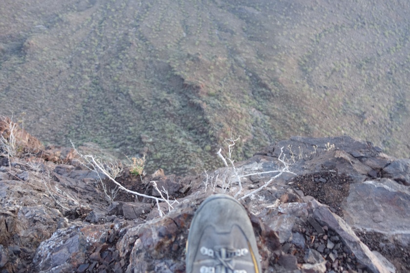
I stumble on a rock. Nothing major but it’s a reminder that I should have replaced my headlight batteries prior to starting this morning.
Like my hike this morning, our lives at times move forward into the unknown. We don’t know what we don’t know, and that’s what makes it so interesting, and, a little scary. Perhaps you are in a similar situation. I suspect you too, feel the weight of the darkness I speak of.
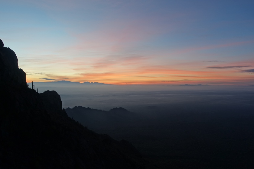
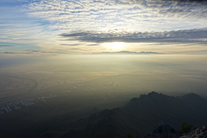
The peripheral portion of my retina bring my awareness back to the here-and-now. The pre-1st light glow has arrived and I am reassured the earth hasn’t ceased it’s rotation. Indeed, first light of day fast approaching.
Tomorrow, I give my notice of resignation. My mind begins to reflect on the over 15 years of patient care experience. I think about the dark force dismantling the legacy I knew. I go over it again. Anger. But then I remember the good people I have worked with along the way. Gratitude. I draft what I want to say:
“To my colleagues and the patients we have cared for: I am moving to another organization. The past 15+ years here have been amazing. You should know how much each of you have contributed to my life and career. So many of you have taught by example, encouraged and admonished me through the years in my various roles: PCT, nursing student, RN, NP Student, and NP. Watching and working with you, I have come to understand the value of quality, safety, integrity, excellence, and compassion. These values have prompted my move, and will stay with me long after my employment here. As I bid those of you I leave behind farewell for now, I want to express my gratitude and admiration for each one of you. Thank you for the privilege of working with you.”
Like this morning, my life moves upward through darkness into the unknown. I can scarcely see the ground beneath me. I know the daylight will return, but at the moment darkness abounds. As I move on to the unwritten chapters of my professional life, I rely on my God and my savior to guide my steps in safety. My prayer is that the next chapter for me, and each of you, turns out as well as the Picacho Summit this morning.
A closing thought hits me at one of the more precarious locations near the summit that I feel must be said: Guard your steps. We don’t always fully consider the importance of each of our steps. Indeed, some are of great consequence: this is true both on the mountain and on the knife- edge we walk in life. Choose wisely. And, if unsure which step to take, consider consulting a guide.
“The mind of man plans his way, But the LORD directs his steps.”
Proverbs 16:9
“Though the fig tree does not bud and there are no grapes on the vines, though the olive crop fails and the fields produce no food, though there are no sheep in the pen and no cattle in the stalls, yet I will rejoice in the LORD, I will be joyful in God my Savior. The Sovereign LORD is my strength; he makes my feet like the feet of a deer, he enables me to tread on the heights.”
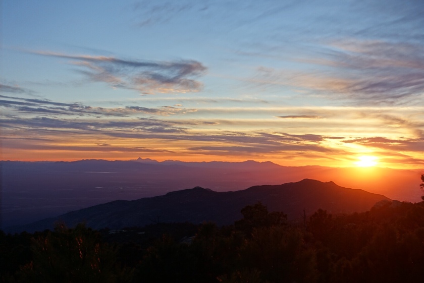
Opportunity comes in many forms. Low pressure and high humidity present rare opportunity in southern Arizona. Low clouds and fog make for pretty spectacular vistas from the summits and ridges around the Tucson area. Feb 16 and 17, 2018.
Wasson Peak, Tucson below and behind, Catalina mountains in the distance.
Tucson Mountains, from the ridge below Wasson
Mica Mountain and Rincon Peak emerge through the fog over Tucson
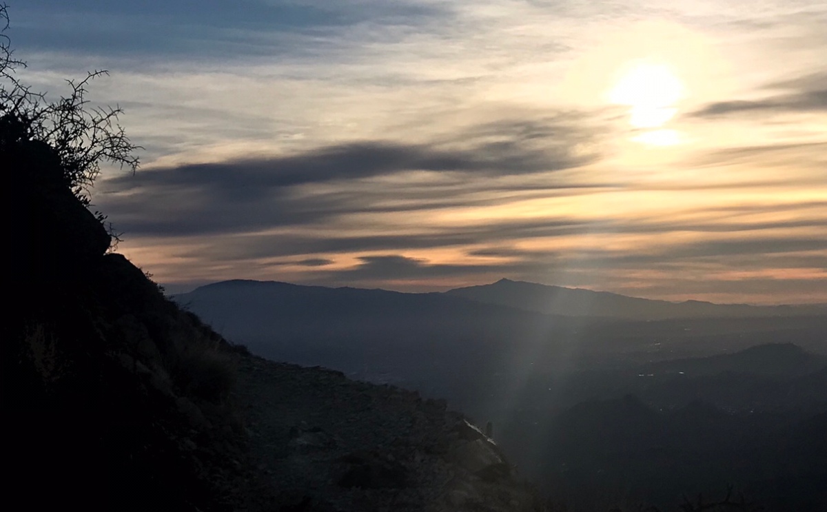
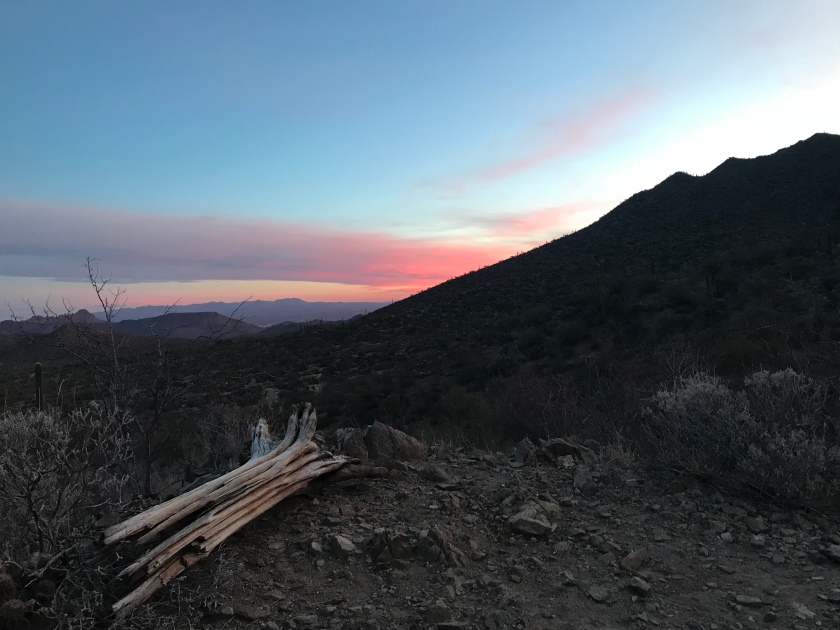
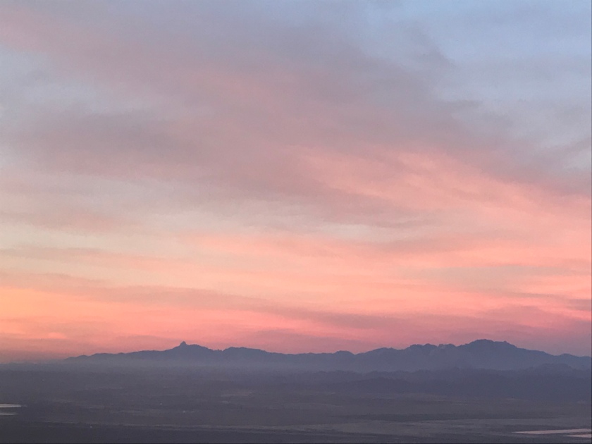
I went for an absolutely perfect hike this morning. As I pull into the Sendero Esperanza trailhead the last few stars are giving way to a faint glow on the far side of Wasson Peak. As I ascend into the Tucson mountains, a gradually cooler breeze offsets my rising body temperature almost perfectly. A faint deep red glow reflects off the thin clouds, eventually yielding to pink over about 30 minutes.
Pink all around. Every blade of grass, grain of sand, Saguaro thorn and distant mountain. The sunlight now illuminating all with no shadow; shades of orange blue and yellow lighting up the sky.
I slowly gain elevation on a perfectly graded and maintained trail. I am climbing Wasson Peak during an amazing February Arizona sunrise and it is all around me.
As I climb, I listen to a blend of Radiohead on my headphones. I almost never listen to music while hiking but it feels right to me today.
As I give thanks to God for a glorious morning with beautiful surroundings my eyes are caught by the distant Rincon Peak as I slowly climb the Ridgeline towards Wasson. I think about the pre-contemplative phase regarding which hike I would do today, when I had considered the 4500 foot 14 mile journey to the top of Rincon as an option. Had I chosen it, I would now be less than 1/4 of the way into a long steep climb.
I think about how much I would have suffered by the end. I think about what my legs, knees, hips, and everything else would feel like. I think about the constitutional despair of the death march. Asthenia. Malaise.
Despite the absolute perfection of my morning on Wasson, I feel a sense of regret. I want to understand why.
The definition of a death march is straightforward: any hike that is long enough and steep enough to make you feel like you’re going to die is a death march. It is a somewhat relative term although there are some hikes which are certainly almost never death marches and others which are almost always death marches.
Where does my longing for this experience come from?
I had actually devised a plan involved purchasing a safety beacon and doing a solo out and back hike to Spud Rock from Reddington Pass. This would be a 20 mile 5000 foot day hike over the steep gravel north face of Mica Mountain.
Who in their right mind would long to do a thing like that while in the midst of one of the most fantastic hikes in the Tucson area at a completely perfect moment?
Perhaps no one in their right mind would long for that.
Yet, I bet some of you long for exactly the thing that I long for.
Nothing subdues the disquieted spirit like the death march.
If you have no idea what I’m talking about, I suggest you give one a try. You’ll be sorry initially, but then happy later, that you did.


 The ascent up the Kaibab Plateau is a gradual, undulating ascent, with the environment slowly progressing from sagebrush to juniper, piñon pine, ponderosa, and finally dense fir forest which unfolds over the 75 miles from Utah to the North Rim.